
The Icefields Parkway highway in the Canadian Rockies offers one of the most scenic drives in the world. During the drive, visitors can access the Columbia Icefields and one of the most accessible glaciers, Athabasca Glacier. Receding at an alarming rate, Athabasca Glacier shrinks back from the highway a little each year.
Travelers can find the Icefields after a two-hour drive north of Banff or one hour journey south of Jasper. Although, those without a vehicle can purchase all-inclusive tours, which include transportation. If you have a hotel in Banff but no car, the tour makes for a full day.
I still remember my first sighting of the Columbia Icefields in 1983. Back then, the terminus of Athabasca Glacier was closer to the road, and visitors could walk onto the ice.
Today, the abundance of meltwater has created a small lake and river, preventing access to its toe. As the need to explore this natural wonder has exploded, travelers can enjoy the icefields in several different ways.
Brewster Ice Explorer Tour
- Location: AB-93, Jasper, AB | Cost: CAD 97+ or cheaper online
Ice Explorer buses or buses with giant wheels drive onto the glacier for an unforgettable excursion. Visitors can purchase tickets from the Columbia Icefields Discovery Centre. The Discovery Centre opens from May 1 to mid-October, depending on the weather.
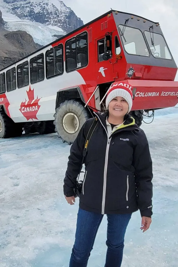
The Columbia Icefield Adventure ticket includes a visit to the Skywalk, a glass floor cantilevered platform hanging over the Sunwapta Valley. While tickets cost more at the center and may require a wait, visitors can purchase passes online as low as CAD 85.
In 2020, a Columbia Icefields bus crash killed three people and injured 14 more. Since then, Pursuit, who owns the buses, has installed seat belts on their vehicles.
While I’ve taken the tour three times, the excursion never ceases to amaze me. The massive tires are as tall (or short) as me at five feet.
The buses travel slowly up and down big hills to access the glacier. Once the buses park on the glacier, visitors have approximately 20 minutes to explore inside a roped area.
I found the glacier’s surface quite slippery and saw a few people take tumbles. If you have crampons, I’d advise you to take them and put them on once you exit the bus. Rivers of varying depths riddle the ice, so be careful not to step in them, or you could be returning with very wet feet.
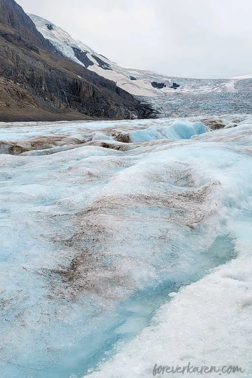
Our bus driver told us we could drink the water from the glacier. After exiting the bus, she directed us to an area where water was rushing in a stream. I watched a few people fill water bottles, but slipped and got wet.
So, we decided to pass on the water tasting. After the glacier tour, we returned to the parking area to board another bus. Then, we continued to the Skywalk.
Tips for visiting: During peak times, it’s best to buy your tickets online to save money and prevent waiting. Also, it can be 10C colder on the glacier and quite frigid. Remember to wear layers, a winter jacket, hat, and gloves.
Hike Wilcox Pass
- Location: Wilcox Creek campground, Jasper, AB | Difficulty: Moderate
I recommend the Wilcox Pass hike for spectacular views of the Columbia Icefields peaks. The trail starts in the Wilcox Creek campground, just south of the icefields. There is a washroom at the beginning, so be sure to use it before your hike.
If you’re looking to camp in the area, the icefields tent and Wilcox Creek campground are close to activities.
While the trek is lengthy at 11 km roundtrip, some only hike to the viewpoint with the red Adirondack chairs. You’ll reach these chairs at about 1.7 km. From this viewpoint, you can admire the views of Mount Athabasca, Mount Andromeda, Athabasca Glacier, and Dome Glacier.
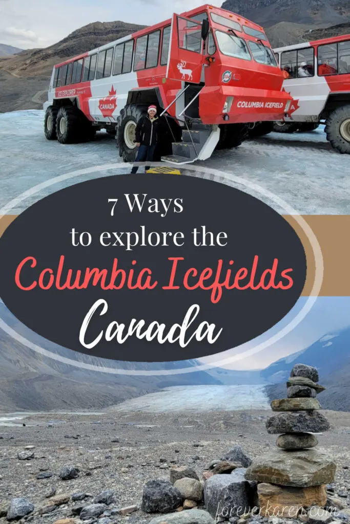
The hike is rated as moderate, although some trail reviews class it as difficult. While the trail itself isn’t that hard, at over 2000 meters, even seasoned hikers might get out of breath due to the thin air.
The trail travels through forested areas, meadows, and over rocks. For stability, some prefer the use of hiking poles.
Due to its proximity to the glaciers across the valley, it can get quite cold, even in summer. So, pack a jacket or a raincoat, as conditions can change quickly in the Canadian Rockies. I encountered snow in July.
If you choose to hike to Wilcox Pass, you may spot Bighorn sheep grazing in the meadows. However, those that prefer the shortened route to Wilcox Ridge will still enjoy incredible vistas.
Tips for visiting: Camp in Wilcox Creek campground or stay at the Glacier View Lodge to get an early start on the hike. The trail can have snow, so dress appropriately.
Take A Guided Ice Walk
- Location: Athabasca Glacier, Jasper, AB | Cost: CAD 70+
Due to the number of people who have perished in crevasses, it’s recommended you venture into the ice with an experienced guide. Guided glacier hikes are suitable for those seven to seventy-seven. You can choose from a leisurely three-hour tour to a lengthy all-day excursion.
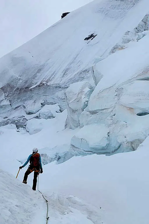
The tour operators supply crampons, waterproof pants, jackets, and boots if you need them. It’s advisable to dress in layers, and bring bottled water, and a snack.
The ice walk isn’t strenuous as the tour travels slowly and takes multiple stops. However, being at a higher elevation with thinner air, some people may get out of breath.
The icefields receive over ten meters of snow each year. This compacts to form glacial ice on the surface of the glacier. As the glacier moves forward, ice conditions constantly change, and cracks or large crevasses appear. With an experienced guide, you’ll know where it’s safe to step.
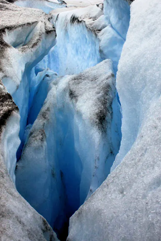
On shorter tours, you’ll explore the lower sections of Athabasca Glacier. However, the all-day hike covers more than 8 km from the glacier’s end to the other. On the tour, you’ll see incredible ice falls, millwells, and learn more about this frozen landscape.
Take A Helicopter Tour
- Location: Junction of Hwy 11 and Cline River, AB | Cost: CAD 700+ (with a minimum of two people)
The views of the Canadian Rockies are breathtaking from the ground. However, the jaw-dropping views from the sky will leave you in awe of its landscape.
Located at Abraham Lake between Lake Louise and Jasper, Rockies Heli Canada offers a helicopter excursion to the Columbia Icefields.
This fantastic 55-minute tour includes cascading waterfalls, turquoise lakes, and endless amounts of ice. You’ll fly over three icefields, including the famed Columbia Icefields, and see imposing snow-capped peaks. Remember to take a camera to capture those killer bird’s eye shots.
While this helicopter tour isn’t cheap, the once-in-a-lifetime experience will create unforgettable memories.
Tips for visiting: Check the weather and book when there’s optimal visibility.
Walk To The Glacier’s Toe
- Location: Columbia Icefields, Jasper, AB | Difficulty: Easy
Across the highway from the Columbia Icefields Discovery Centre, a road leads to a gravel parking lot. Here, visitors can hike to the terminus and see Athabasca Glacier without paying a fee.
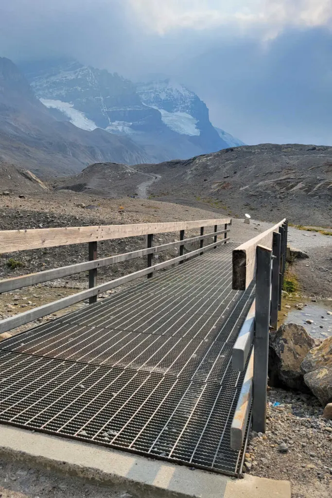
Dress warmly as the winds whipping off the glacier are pretty frigid. The forefield trail starts by crossing a bridge and continues uphill over a moraine.
Back in the 1980s, the walk was relatively short, and only a tiny amount of meltwater was trickling off the icefield. Today, as you stroll the rocky moraine, markers show where the glacier used to end in previous years.
In 2021, I was astonished at how much the glacier had receded. I could see lines in large rocks on the trail, created as the glacier carried stones over them.
Informational plaques explain how glaciers are formed and how the glacier flour creates those beautiful turquoise tones in nearby lakes. When you reach a fork in the path, go left and hike the looping trail.
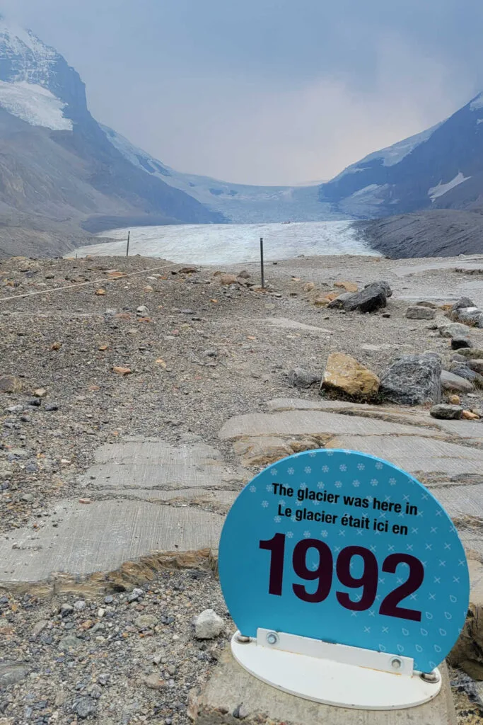
At the end of the pathway, a wide meltwater river flows heavily downstream. Here, a roped area discourages visitors from venturing onto the ice. Then, the trail turns right and loops back to the parking lot.
Athabasca Glacier is one of seven glaciers in the Columbia Icefields. The icefields are so large that it lies in Alberta, but the majority of the glaciers sit in British Columbia. It’s interesting to note meltwater from the icefield runs into three oceans, the Pacific, Atlantic, and Arctic.
Hike Parker’s Ridge
- Location: Near the northern border of Banff National Park, Banff, AB | Difficulty: Moderate
Nine Kilometers south of the Columbia Icefields Discovery Centre, a trail leads to the top of Parker’s Ridge. Here, you can enjoy incredible views of Saskatchewan Glacier. The short but strenuous hike attracts a crowd, and the trail is considered one of Banff’s popular hikes.
I camped at Wilcox Creek campground to get an early start on this trail. While getting up at 5 am was no fun, I could enjoy the path without anyone else. Plus, I got to watch a spectacular sunrise on the ridge. The trail starts with some steep switchbacks. With thin air, you’ll be out of breath quickly.
Towards the top, the vegetation becomes sparse as the harsh winters make it difficult for anything to grow. At the peak, you’ll need a jacket as the strong winds can cool you. If you’re lucky as I was, you might see mountain goats on nearby hills. So, bring a pair of compact binoculars to increase your chances of seeing wildlife.
Hikers can see Saskatchewan Glacier on the ridge, the longest glacier flowing from the Columbia Icefields. Like many other glaciers in the Rockies, Saskatchewan Glacier is receding at an alarming rate. It’s estimated the Alberta glacier has melted back almost 1,400 meters between 1893 and 1953.
On my 270-meter descent down from Parker’s Ridge, I met the morning crowd making their way up.
Tips for visiting: Dress in layers as it can be cold and windy on the ridge. I suggest you arrive before dawn to avoid a crowd on the trail and increase your chance of seeing wildlife.
Hike To Saskatchewan Glacier
- Location: Near the Big Bend, Banff National Park, AB | Difficulty: Moderate
A trek to Saskatchewan Glacier allows hikers to walk on the ice or enjoy a glacier up close. While the journey is long at 14 km roundtrip, you’ll have the glacier to yourselves in most cases.
The Saskatchewan Glacier trail is a favorite amongst locals who prefer a less crowded route and this trail certainly delivers that. Hikers will find this trailhead unmarked, just south of the Columbia Icefield Discovery Centre.
When driving north, pull off on a gravel road on the left side, before the Big Bend. The road slopes down from the road and ends at a concrete bridge. The area close to the bridge allows for three cars to park.
To walk this trail, hikers need an early start, pack a jacket, and take plenty of water. It took me eight hours to complete this trail without walking on the glacier.
Final Thoughts
There are few places in the world where travelers can access an icefield without taking a cruise or trekking a lengthy distance. But, with just a drive, global travelers can explore the icy landscape of Columbia Icefields in the Canadian Rockies.
While I’ve visited multiple times, the incredible frozen environment still captivates me.
Happy travels ~ Karen
