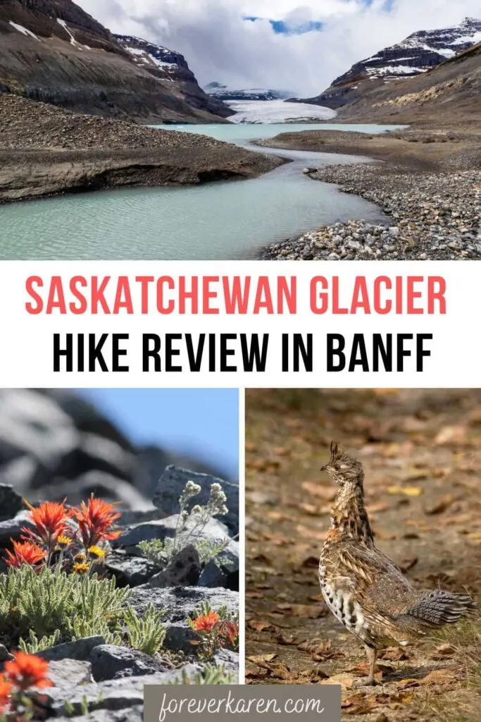
Located in the Canadian Rockies, Banff National Park has a myriad of hiking trails to suit every activity level. In particular, the moderately challenging Saskatchewan Glacier hike is long and rarely traveled.
Hikers taking on this unmaintained path will find the trailhead unmarked and the route unnoticeable in places. However, the reward for completing this trail is having an entire valley and glacier to yourself!
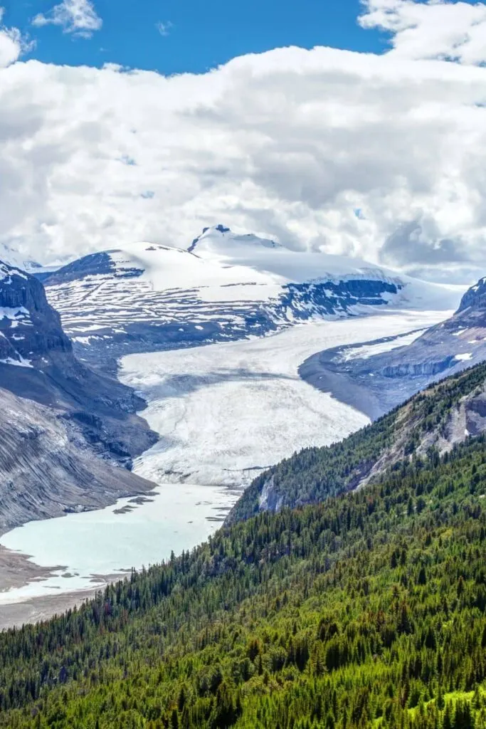
The majority of hikers see Saskatchewan Glacier from the top of Parker Ridge, off the Icefields Parkway. While the Parker Ridge trail requires a steady uphill climb, the rewards are high for little effort.
After completing the short hike, I decided to take the longer route to the toe of the Saskatchewan Glacier.
Depending on whether you plan to walk on the glacier, the 14 km (8.7 miles) roundtrip hiking trip can take as long as ten hours. So, plan to start early in the day to ensure you won’t be returning in the dark.
I camped at the Wilcox Creek campground in to ensure an early start. Both Wilcox Creek and Icefields Tent provide the closest access to the trailhead.
It’s important to note while locals hike this trail, few visitors to Banff choose this day hike. So, make sure you pack the right supplies because you may not see another person all day if you run into trouble.
What To Take On The Trail
- Waterproof jacket, in case it rains.
- Crampons, if you plan to walk on the glacier.
- Water, protein bars, or protein-rich food.
- Collapsible hiking pole to use on the ice and rocky areas of the trail.
- Emergency kit.
- Bear spray (because you’re in bear country) and know how to use it.
- Bear bell to keep away the bears, hopefully.
- Wear hiking boots with ankle support to prevent ankle sprains.
- Sunscreen for hot days because most of the trail has no sun protection.
- Camera or phone to capture those fantastic memories.
- Flashlight or headlamp if there’s a chance you’ll be hiking in the dark.
Since the hike takes all day, make sure to carry the appropriate amount of water. A good guideline is half a liter for every 30 minutes of hiking. Although, this amount can increase to one liter during hot weather.
Should you not want to carry that much liquid, consider using a Lifestraw to remove bacteria and parasites from the river water.
Saskatchewan Glacier Trailhead
Saskatchewan Glacier is the largest outflowing glacier of the Columbia Icefields. As a receding glacier, its meltwater has created a lake at its terminus, and if you’re lucky, you’ll see icebergs in the tarn.
With each passing year, the lake grows in size, making accessibility to the glacier more challenging.
The water flows eastwards and feeds into the that empties into Lake Winnipeg in Manitoba. Unlike the popular trails in Banff, the trailhead to is unmarked.
Located southeast of the Columbia Icefield Discovery Centre, pull off onto a gravel road near the Big Bend when traveling north on the Icefields Parkway. If you reach the Big Bend, you’ve gone too far, so turn around and drive back.
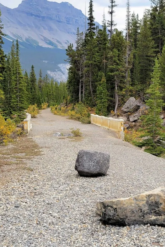
The gravel road runs downwards off the south side of the highway, and there should be an old concrete bridge nearby. If you don’t see an old bridge, you’ve chosen the wrong dirt road.
The water that runs alongside the highway disappears into a canyon and runs under the old abandoned concrete bridge.
The parking area can accommodate three to four cars and provides access to the Saskatchewan Glacier trail and Big Bend Peak. Since this is an unmaintained trail, there are no signs to indicate a trail starts here.
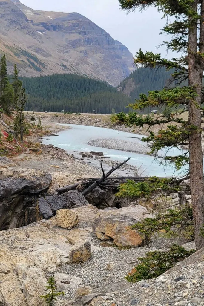
From the parking area, the trail begins by crossing the abandoned concrete bridge. Turn right and follow the gravel path downwards towards the North Saskatchewan River.
The abandoned bridge is in rough shape, and it may be a matter of time before it’s gone. As an alternative, you can hike the series of switchbacks to the crest of Parker Ridge, and descend down the other side to Saskatchewan Glacier.
The Parker Ridge trailhead is close to the HI Hilda Creek Wilderness Hostel.
Saskatchewan Glacier Trail
Continue on the gravel route until you reach the tree line. Old road tracks created by the army in the 1930s meanders up into the trees and provides the only shade on this long trail.
At first, I thought this would be an easy trail, since it didn’t have much elevation gain. However, I later realized the hard part was leaping across rocks on the rocky terminus.
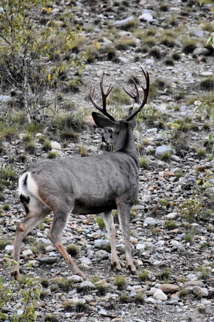
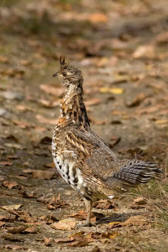
Be aware that grizzly bears frequent this portion of the trail. In fact, during my hike, I noticed fresh grizzly tracks in the mud. While I didn’t see a bear, I did encounter a mule deer and a grouse looking quite camouflaged in their surroundings.
Follow the gravel road down the other side of the mountain to an old food stash. Here, I saw a small waterfall and some interesting rocks. The route to Saskatchewan Glacier offers two options from here.
Turn left for a picturesque and easier route, although you cannot access the glacier. Alternatively, the right route offers access to climb onto the glacier should you have crampons.
However, the trail is much more dangerous because hikers make the Saskatchewan River crossing using fallen trees. Do not attempt this route without the proper safety equipment because a fall into the deep canyon will be fatal.
I chose the more scenic path along the south side of the North Saskatchewan River. Starting the long walk across the pebbly valley seemed easy enough. The distant views of the glacier teased me, and played peek-a-boo from behind a mountain.
The surrounding scenery is beautiful, with Parker Ridge to the north, Cirrus Mountain to the east, and a steep rock face to the south.
Here, I could also see the highway and Big Bend. When deciding to tackle this hike, it’s advisable to pick a day with a good weather forecast since this walk along the gravel flats provides no shelter from the elements.
Shale On The Trail
Walking the valley, I felt like the hike to the glacier seemed to take forever, and I took numerous snack breaks along the way. I now understand the popularity of the shorter Parker Ridge hike.
I could see Saskatchewan Glacier in the distance and kept telling myself, “It’s only a little bit further.” But in fact, the 5 km hike across the rocky flats seemed much longer.
There is no actual trail in the valley, just open terrain. So, keep looking ahead and walk toward the glacier. The rocks grew from pebble size to large stepping stones and, in some areas, became a tripping hazard.
Due to the terrain, the trek across the rocky valley floor was slow. I was thankful to have hiking boots with good ankle support. The rocks are interesting and come in different shades. If you’re prone to tripping, I suggest using collapsible hiking poles.
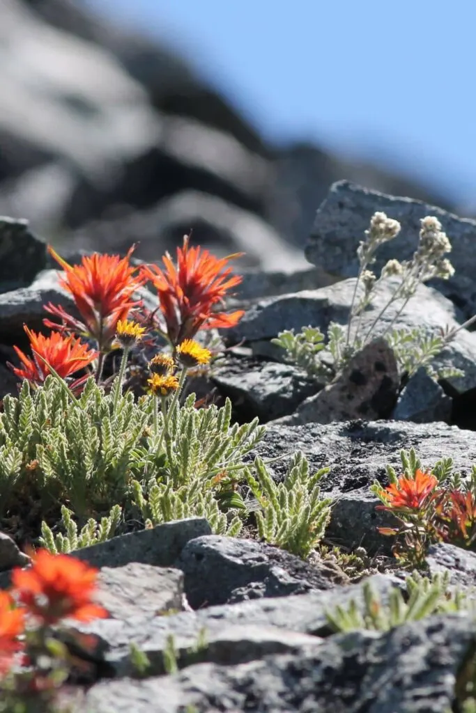
Not much grows in the valley, probably due to significant snowfall in winter. However, I found the odd, vibrant wildflower flourishing amongst the rocks.
Since I was in July, small waterfalls cascaded from the southern cliffs. Should you have a pair of compact binoculars, mountain goats frequent and Bighorn sheep frequent the area too.
Nearing the glacier’s terminus, I discovered an outcropping of shale. Knowing that shale often contains fossils, I examined the large pieces. To my surprise, the shale was full of trilobite fossils and some complete specimens.
It was a fantastic find and almost as rewarding as the hike itself. Remember, hikers must not remove such items and leave no trace when trekking in the national parks.
Reaching Saskatchewan Glacier
Trying to be aware of the time, I hiked onwards to the prize that seemed so close yet so far. Along the route, previous visitors have made cairns to mark the pathway through the rocky landscape.
Finally, after what seemed like an eternity, I reached the lake formed at the glacier’s toe, but I could not access the ice. Some of the ice was covered in debris, and pieces of ice had calved into the waters below.

Like many of the glaciers in the Canadian Rockies, Saskatchewan Glacier is rapidly receding. As it melts, the lake in front of it grows larger and makes accessing the toe more challenging.
This was the perfect place to enjoy lunch and appreciate the fact that I had conquered the hike and reached a glacier that not many hikers experience. Now, it was time to start on the long journey back.
Remember to keep track of the hours and only walk for half your allowable time, even if it means not reaching the destination. With an unmarked unofficial trail, you don’t want to be hiking after the sun goes down, or you’ll risk getting lost.
Hiking the Saskatchewan Glacier trail took me eight hours, but I stopped many times along the way. I could have spent much longer exploring the valley and enjoying the solitude.
If you plan to tackle this hike, the summer solstice is the best time to maximize your daylight hours. While a lot of people don’t venture there, you’ll enjoy the solitude of this trail.
Sometimes, getting off the beaten path and exploring less-traveled routes offer the nicest surprises. If you prefer to avoid the crowds in Banff, I’d highly recommend in Yoko .
Should you want to walk on a glacier without a long hike, the Columbia Icefields Discovery Centre sells snow bus tours onto Athabasca Glacier. The tours are family-friendly and a great way to experience the ice without any effort.

